Pick Up
1433. 2026 Kicks Off With Extreme Heat, Cold, Rain, and Fires

1433. 2026 Kicks Off With Extreme Heat, Cold, Rain, and Fires
Long-term temperature increases are leading to an increase in the frequency of extreme weather events. The World Meteorological Organization (WMO) noted the significant economic, environmental, and human impacts of extreme weather reported around the world in the first few weeks of 2026, and emphasized the importance of investing in accurate and timely forecasts and early warning systems.
Extreme Heat and Bushfires
In January, much of Australia was hit by two heatwaves, creating weather conditions that increased the risk of fires. In Ceduna, South Australia, temperatures reached 49.5°C on January 26, setting a new record for the region. The late January heatwave was the second to hit Australia in less than a month. In Chile, deadly wildfires raged in the provinces of Bío Bío and Núble, forcing tens of thousands to evacuate. Extreme heat and strong winds fueled the spread of 75 fires, leading to the declaration of a state of catastrophe. In southern Argentina, a combination of high temperatures, prolonged drought, and strong winds sparked devastating fires in the Patagonia region.
According to the Intergovernmental Panel on Climate Change (IPCC) Sixth Assessment Report, human-induced climate change has increased the frequency and intensity of heatwaves since the 1950s, and continued warming is expected to further increase their frequency and intensity. The WMO is strengthening its response to extreme heat and heatwaves, including by introducing a new framework and toolkit to help countries strengthen governance, coordination, and investment in addressing extreme heat risks. WMO has established a Joint Office on Climate and Health with the World Health Organization (WHO) and is one of the co-sponsors of the Global Heatstroke Information Network. It is also working with member states and partners to develop a comprehensive, interdisciplinary global strategy to strengthen wildfire early warning and advisory services.
Extreme Cold and Winter Storms
According to the IPCC, the frequency and intensity of extreme cold events have decreased globally since 1950, and average winter temperatures have increased. However, long-term global climate trends do not eliminate the occurrence of extreme weather and localized cold spells. The weakening and distortion of the polar vortex has increased the amplitude of the polar jet stream, promoting widespread inflows of cold air into mid-latitudes, causing severe cold spells and triggering destructive winter storms in North America, Europe, and Asia. The polar vortex is a massive current of cold air and strong winds that typically circles the Arctic. When the polar vortex weakens, Arctic air flows southward, drawing warmer air into the Arctic.
Some weather forecasts predict that rapid warming in the stratosphere above the Arctic will significantly weaken the polar vortex in early February, further increasing the risk of Arctic air invading North America and Northern Europe in late February.
More than 2 meters of snow fell in Russia's Kamchatka Peninsula in the first two weeks of January, following 3.7 meters in December. According to the Kamchatka Hydrometeorological Center, these snowfalls represent one of the heaviest periods recorded on the peninsula since the 1970s. In the regional capital of Petropavlovsk-Kamchatsky, traffic was paralyzed with reports of cars being buried under large snowdrifts, blocking access to buildings and infrastructure.
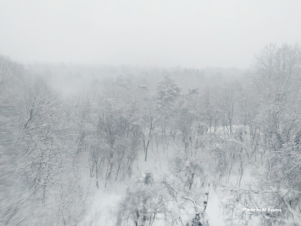
Heavy snowfall continues in parts of Japan this year. According to the Japan Meteorological Agency, Aomori Prefecture recorded 1.7 meters of snow as of February 3, the highest amount in the past 40 years. The highest snow depth recorded in Aomori since records began in 1893 was 209 cm, observed on February 21, 1945.
Extremely heavy rain and snowfall have occurred in northern Afghanistan, Pakistan, India, and western Nepal, prompting warnings of flooding and avalanches.
A series of storms in Europe has caused heavy rain, strong winds, and high waves, disrupting transportation networks and causing flooding in many countries, from Ireland and the United Kingdom (western) to Portugal, Spain, and the entire Mediterranean region. Above-average rainfall is forecast for Greenland, northwestern and western Europe, and parts of the Mediterranean region over the next two weeks. Arctic cold is also forecast to spread again over the next few weeks, particularly in northern and northeastern Europe.
Heavy Rain and Flooding
The WMO warned on January 22 that extremely heavy rains are continuing in southeastern Africa. Weeks of heavy rain have caused rivers to swell, overflowing major reservoirs and flooding densely populated areas. Mozambique was hit hardest by the floods, affecting at least 650,000 people, displacing hundreds of thousands, and destroying or damaging at least 30,000 homes. The United Nations Office for the Coordination of Humanitarian Affairs (OCHA) stated that crops have been destroyed, livestock have died, and the risk of waterborne diseases such as cholera has increased. According to World Weather Attribution, the combination of climate change and the La Niña weather phenomenon created a "perfect storm" for the floods in southern Africa, which hit Mozambique, South Africa, Zimbabwe, and Eswatini. The study found that the intensity of heavy rainfall has increased by 40% since pre-industrial times, with some areas receiving more than a year's worth of rainfall in just a few days.
In Indonesia, more than 50 people died in a landslide in West Java on January 24. While the landslide was caused by heavy rain, the underlying causes of the tragedy lie in more complex risk factors, including geological characteristics, slope gradient, soil stability, and unsustainable land-use practices.
Contributor: IIYAMA Miyuki, Information Program
