Pick Up
1374. Extreme Heat and Heavy Rainfall in Okinawa (Takaragawa’s Newsletter vol. 9)
Related Research Program
Information
1374. Extreme Heat and Heavy Rainfall in Okinawa (Takaragawa’s Newsletter vol. 9)
In Okinawa this year, abnormal climatic conditions such as high temperatures and droughts has been prominent. The average temperature in September was 29.7°C in Naha, which is 1.8°C higher than the long-term average (the highest on record), and 29.8°C in Ishigaki, which is 1.6°C higher than the long-term average (the second highest on record). October also remained hot until mid-month, with nighttime temperatures never falling below 26°C. Since then, it has been rainy until the end of the month. One factor contributing to this unusually prolonged heatwave is that sea surface temperatures did not drop significantly this year. This is partly because there were many sunny days and fewer typhoons approached the region.
The Okinawa Regional Headquarters (Japan Meteorology Agency) provided a clear explanation of the relationship between the high temperatures and extreme rainfall, which I will share here. Water vapor is the amount of water contained in the air. When this exceeds a threshold (the saturation vapor pressure), the air can no longer hold any more water, and rain falls. Imagine the amount of water the air can hold, replaced by a “shishi-odoshi.” In Japanese gardens, the elegant “shishi-odoshi” features water flowing through a bamboo tube. When the water level rises too high, the tube tilts and spills water. As the tube returns upright, it strikes stones or other objects, producing a melodic sound. At high temperatures, the shishi-odoshi's capacity increases, meaning it takes longer for the water to spill (which, in the context of weather, means drought). When it does spill, it gushes out in a torrent (which, in the context of weather, means heavy rain).
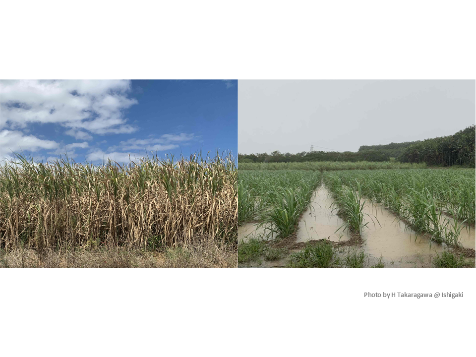
Sugarcane production in Okinawa involves spring planting, summer planting, and ratoon cropping utilizing stubble regrowth after winter harvest. This year, low temperatures in February and March stunted growth, preventing adequate root and tiller development before the rainy season. A short rainy season with low rainfall, coupled with an unusually prolonged drought trend since July, has caused significant drought damage, particularly in areas with restricted irrigation. Rain finally began in mid-October, but the pattern of heavy downpours and prolonged rainfall has caused flooding and lodging, creating a true multi-stress situation. From November onward, even on clear days, temperatures gradually drop, reducing photosynthesis and initiating sugar accumulation. Consequently, significant further growth is not expected.
Furthermore, in years with fewer typhoons, the likelihood of a major typhoon arriving after October increases. Large sugarcane stalks are more prone to breaking or lodging, and leaf damage also contributes to lower sugar content. For sugarcane, which thrives in high temperatures, damage from extreme rainfall appears more significant than harm from heat itself. Tropical fruit trees like mango, cultivated in greenhouses in Japan, are exposed to hotter and more humid conditions than outdoors. Particularly when nighttime temperatures remain high, growth of branches and leaves continues undisturbed, preventing dormancy and hindering winter flower bud formation. As these examples show, even a slight rise in temperature can significantly impact current growth and future production.
Contributor: TAKARAGAWA Hiroo, Tropical Agriculture Research Front